| MDFS::Docs.Sheffield | Search |
| Title | Version | Date | Files | Size | Description |
| Members 1974-2003 | 1974.xls 1974.csv 1974.htm | 148K 28K 121K | A spreadsheet listing all elected members of Sheffield City Council year by year since 1974, coloured by party affiliation. Supplied as Excel spreadsheet, CSV file and HTML document. | ||
| Members 2004- | 2004.xls 2004.csv 2004.htm | 46K 7K 40K | A spreadsheet listing all elected members of Sheffield City Council year by year since 2004, coloured by party affiliation. Supplied as Excel spreadsheet, CSV file and HTML document. | ||
| CityMaps | CityMaps | Maps of political control of Sheffield over the years from 1980 to 2004. | |||
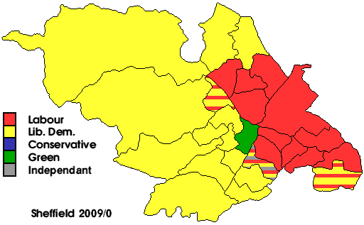
| CityMaps | CityMaps | Map of current political control of Sheffield. | |||
| CouncilTax | City.htm Levels.htm | 6K 5K | Council Tax levels for Sheffield City Council. | ||
| Borders | Borders | Sheffield's changing borders as the city expanded and took in adjoining parts of Derbyshire and the West Riding. | |||
| Hills | Hills | The seven hills of Sheffield. | |||
| Election | Election | City Council election data: candidates, results and votes cast. | |||
| IT | IT | Various reports and documents covering ICT provision within the City Council and the work of the I[C]T [Steering|Working] Group. | |||
| WardReview | Documents on future electoral arrangements for Sheffield City Council. | ||||
| ParlReview | Documents on future Parliamentary Constituency electoral arrangements in the area covered by Sheffield City Council. |